
Remote Sensing Capability Reshapes Premium Geospatial Platform Design Worldwide
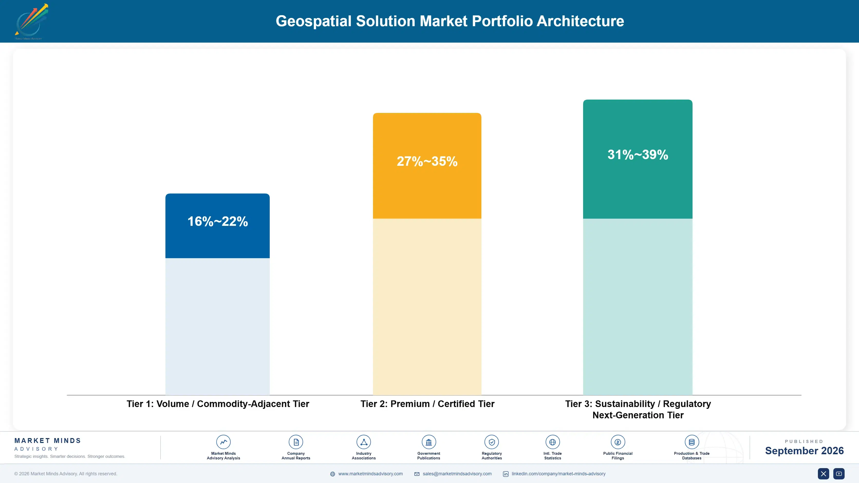
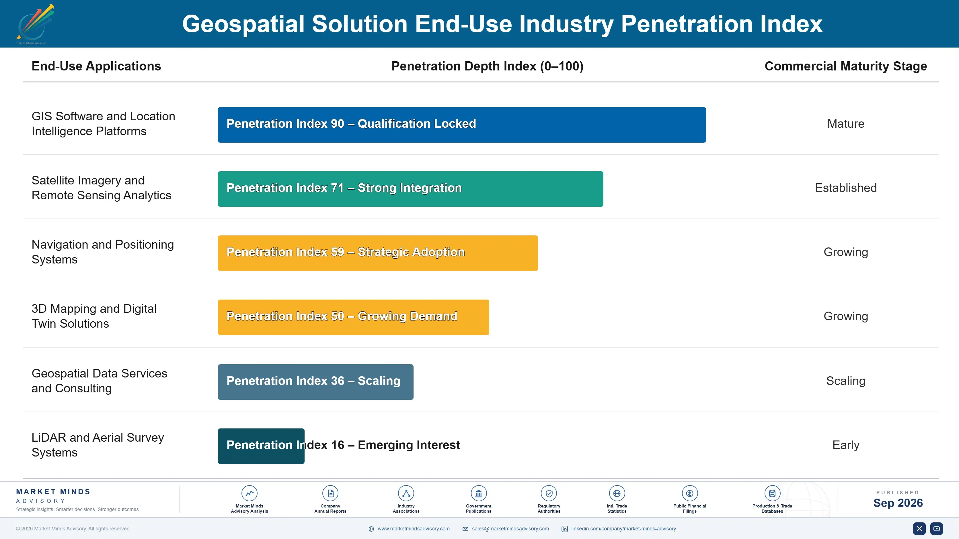
Vendors increasingly reformulate premium platform lines toward genuine remote-sensing and AI-analytics capability rather than conventional static-cartography design, since spatial-accuracy credibility genuinely requires the satellite-integration older standard formats cannot provide across nearly every premium regulated enterprise application tracked in this report. Roughly 24% of new solution deployments now feature documented remote-sensing or advanced AI-analytics construction, up meaningfully from a decade ago when standard static-cartography formats alone remained the unquestioned default across nearly every spatial category. This shift raises average contract price while locking enterprises into vendor relationships smaller regional providers cannot easily contest.
Market Impact: Broadened across 18% more categories